Restoration Raters
Imagine that you could travel a year into the future and witness the change of a landscape throughout the seasons. We did that, and you're about to learn all about it.
We, the Restoration Raters track and record the process and progress of the construction at FernHill Wetlands. By restoration we mean that Clean Water Services is rebuilding the wetlands to make it a better place to liver for animals and make it prettier for tourists. We use a method called photo point to compare the before and after pictures to see how the restoration has changed through the seasons at the wetlands.
We, the Restoration Raters track and record the process and progress of the construction at FernHill Wetlands. By restoration we mean that Clean Water Services is rebuilding the wetlands to make it a better place to liver for animals and make it prettier for tourists. We use a method called photo point to compare the before and after pictures to see how the restoration has changed through the seasons at the wetlands.
Question:
How will the appearance of the wetlands change over fall and winter this year during the restoration construction process?
Methods:
On every visit to collect data we measured water level, took observations on erosion and vegetation and we took photo point pictures. They're taken from different spots around the restoration area: the Water Garden, Dabblers marsh and the experimental wetlands. I'll explain what photo point is. Photo point is taking pictures at an angle and coming back to that very spot after a while, to then take more pictures.
You then compare the photos to see changes over time.
|
|
|
Findings
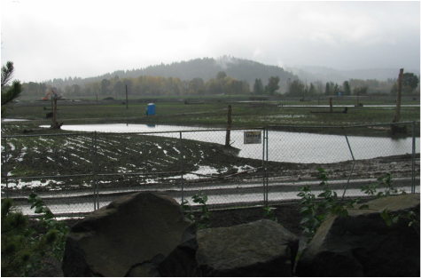
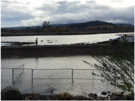
Above, you can see we're looking at the changes in the wetlands over the seasons using photo point. It November it was wet and there was vegetation. It was gloomy and bare in February. In May, it was greener and the trucks and equipment were gone.
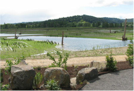
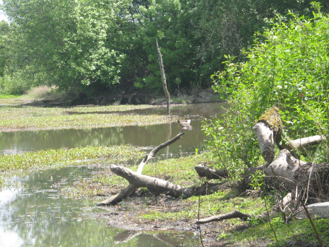
Below, notice the changes that happened between November and May at Dabbler's Marsh. For this photo point, we used a GPS to record our exact location with latitude and longitude and took a picture. Over the year we did see change. The weather also changed for the better as you will see in other pictures .
Above, you can see we're looking at the changes in the wetlands over the seasons using photo point. It November it was wet and there was vegetation. It was gloomy and bare in February. In May, it was greener and the trucks and equipment were gone.
Below, notice the changes that happened between November and May at Dabbler's Marsh. For this photo point, we used a GPS to record our exact location with latitude and longitude and took a picture. Over the year we did see change. The weather also changed for the better as you will see in other pictures .
|
|
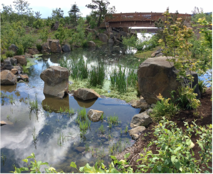
This photo of the Water Garden is from May.
|
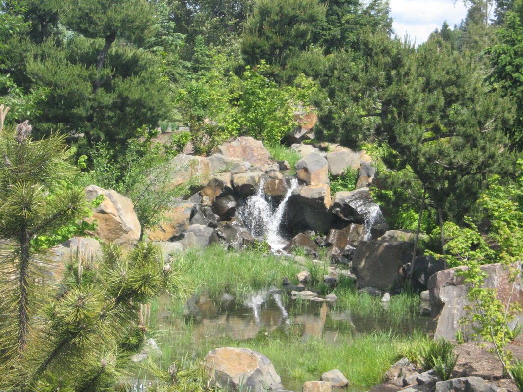
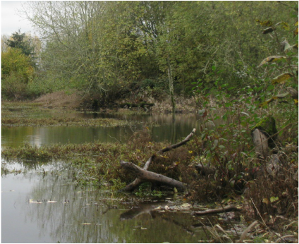
Clean Water Services turned on the waterfall, and water began to flow through the Experimental Wetlands into the restoration area.
|
Reflection:
Our photo-point study at FernHill wetlands was really fun and simple to execute, making it even more fun. We enjoyed spending time outside and working with all the cool equipment. The hardest thing about our study was finding the exact coordinates for each photo on the 2nd and 3rd visits. We learned that finding coordinates takes patience and team work. We should keep coming back because it was fun and we got to learn a lot of new stuff.
Conclusion:
Our hypothesis was correct, the wetlands did change over fall and winter. The seasons and construction made the changes that we saw its going to keep changing and its going to look more natural. Our study might not have been perfect because we couldn't find the same coordinates and pictures. Our study leaves us wondering if we would find the exact same spot now that the wetlands keeps changing.
Now tell us what you think...
|
|
|
|
